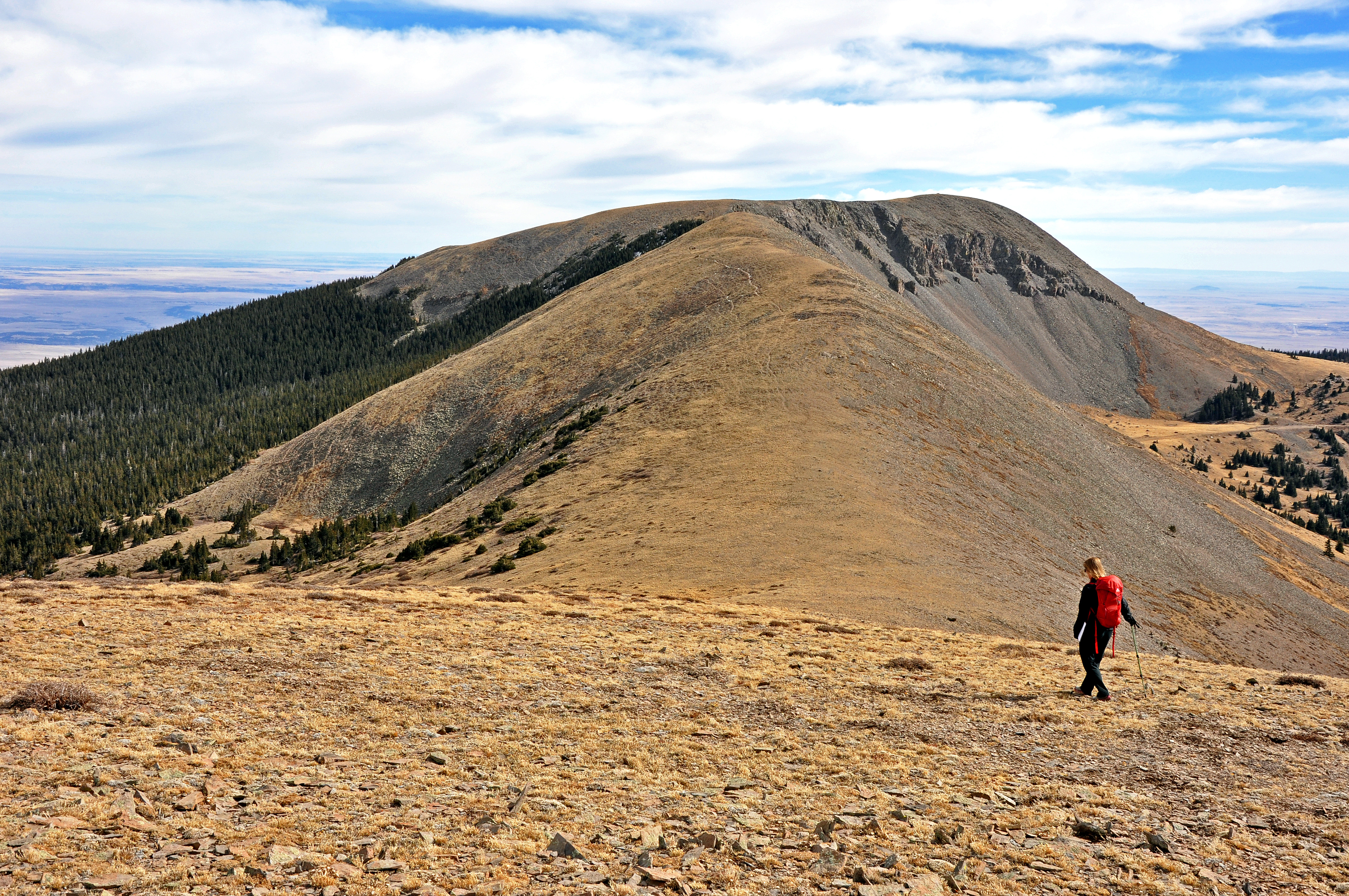
Greenhorn Mountain (12,347′) in San Isabel National Forest can be reached with a 5.2 mile 1,300′ elevation roundtrip hike from the Upper Greenhorn Trailhead. Photo by Stewart M. Green.
Greenhorn Mountain is the highpoint of the Wet Mountains, a range that picks up where Colorado’s Front Range ends, at the Cañon City Embayment near Cañon City. The Wet Mountains were formed by the San Isabel batholith and a faulted anticline, evidenced by the smooth-shouldered, rolling hills of the range.
Named for the prevalent moisture of the area in a predominantly dry region of the state, the Wet Mountains hold snow late into the springtime, and the melt-off feeds numerous waterways that filter through the surrounding, green valleys. Bighorn sheep make their home on Greenhorn Mountain.
The name of the peak refers to Cuerno Verde, Spanish for “Green Horn,” the nickname of Comanche Chief Tabivo Naritgant, known for the green-tinted bison horn that adorned his battle headdress. The chief inherited the helmet and the nickname from his father, who was killed by Spanish explorers in an act that set in motion Naritgant’s tribal requisite to avenge his father’s death. The ongoing battle between Naritgant and the Spaniards ended when the chief—along with his first born son and about a dozen others of the Comanche tribe—was killed in combat near Greenhorn Mountain on September 3, 1779, by Spanish troops and Native American allies under army captain Juan Bautista de Anza. Naritgant’s headdress was brought to Spain as a trophy for King Charles III, who presented it to Pope Pius VI, and the battle helmet of Chief Naritgant remains in the collection of the Vatican Museums.
From the summit of Greenhorn Mountain, the surrounding plains and valleys—sites of numerous battles between Spaniards and Comanches—may be viewed. Easily recognizable peaks visible from the summit include the isolated mound of 6er Huerfano Butte, along I-25 far below and to the northeast; the imposing twin summits of 12er East Spanish Peak and Spanish Peaks highpoint, 13er West Spanish Peak to the south; and the twin 13er summits of the Buffalo Peaks near Trout Pass to the northwest. In addition, on a clear day and with a keen eye, you can count as many as twenty 14,000-foot peaks from the summit. Looking southwest and turning clockwise, the following ranges are visible: the Blanca Group to the southwest; the Crestones and Great Sand Dunes, across the Wet Mountain Valley to the west; the Sawatch Range to the northwest; and the Front Range, including the Pikes Peak massif, to the north.
A plaque in Greenhorn Meadows Park, Colorado City commemorates the defeat of Comanche Chief Tabivo Naritgant, or “Green Horn,” referring to him as the “Cruel Scourge.” Greenhorn Mountain and the Greenhorn Mountain Wilderness present a kinder tribute to the man who lost his father, his son, and his life to western expansion.
Climbing Colorado’s Mountains (October 2015, FalconGuides) features driving directions, route descriptions, maps, photos and GPS waypoints to more than 100 Colorado summits.
