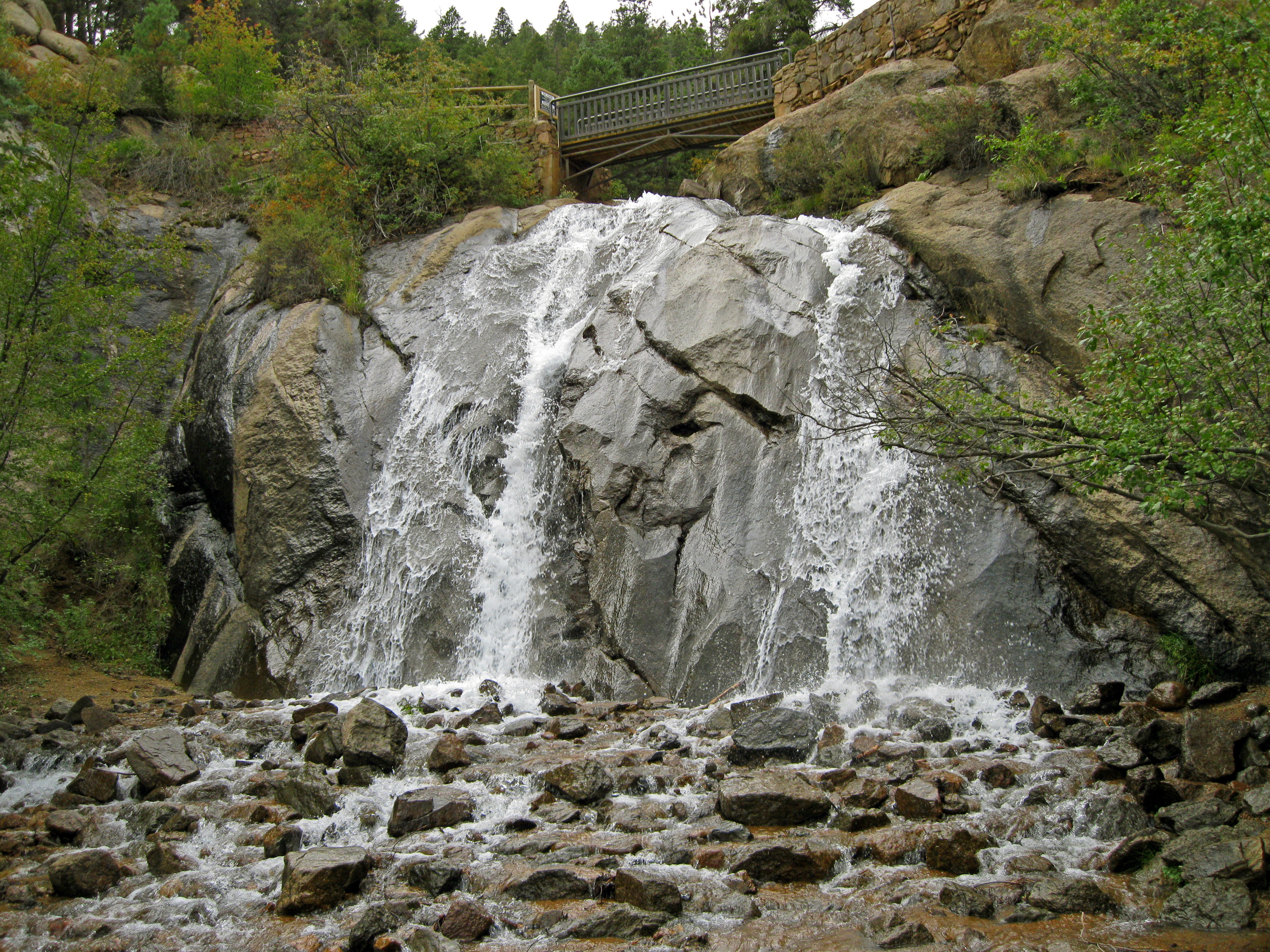
Four Easy Summits on Pikes Peak

Climbing Pikes Peak (14,115) is a big day no matter which trail you take. Most people do the classic Barr Trail route from Manitou Springs (about 26 miles roundtrip), or the shorter Crags route from Divide (about 13 miles).

I’ve done it both ways (once on Barr and six times via the Crags), and also hiked it from Gillet on the old Gillet Trail (shorter than Barr Trail and less steep than the Crags route). In 2006, as part of the Zebulon Pike Bicentennial Climb, I did it over three days and 26 miles one way, starting in southeast Colorado Springs and climbing over several other mountains along the way, presumably following Pike’s 1806 path.

If you want to skip the long hike up America’s Mountain, you can drive to the top on the paved Pikes Peak Highway. The new summit house is open, complete with gift shop, cafe, and exhibits, and the wraparound viewing decks are complete. All you need from late-May through the end of September is a permit. A few miles up the road, you’ll hit the entrance station, where you have to pay another $15 per adult, less for kids.

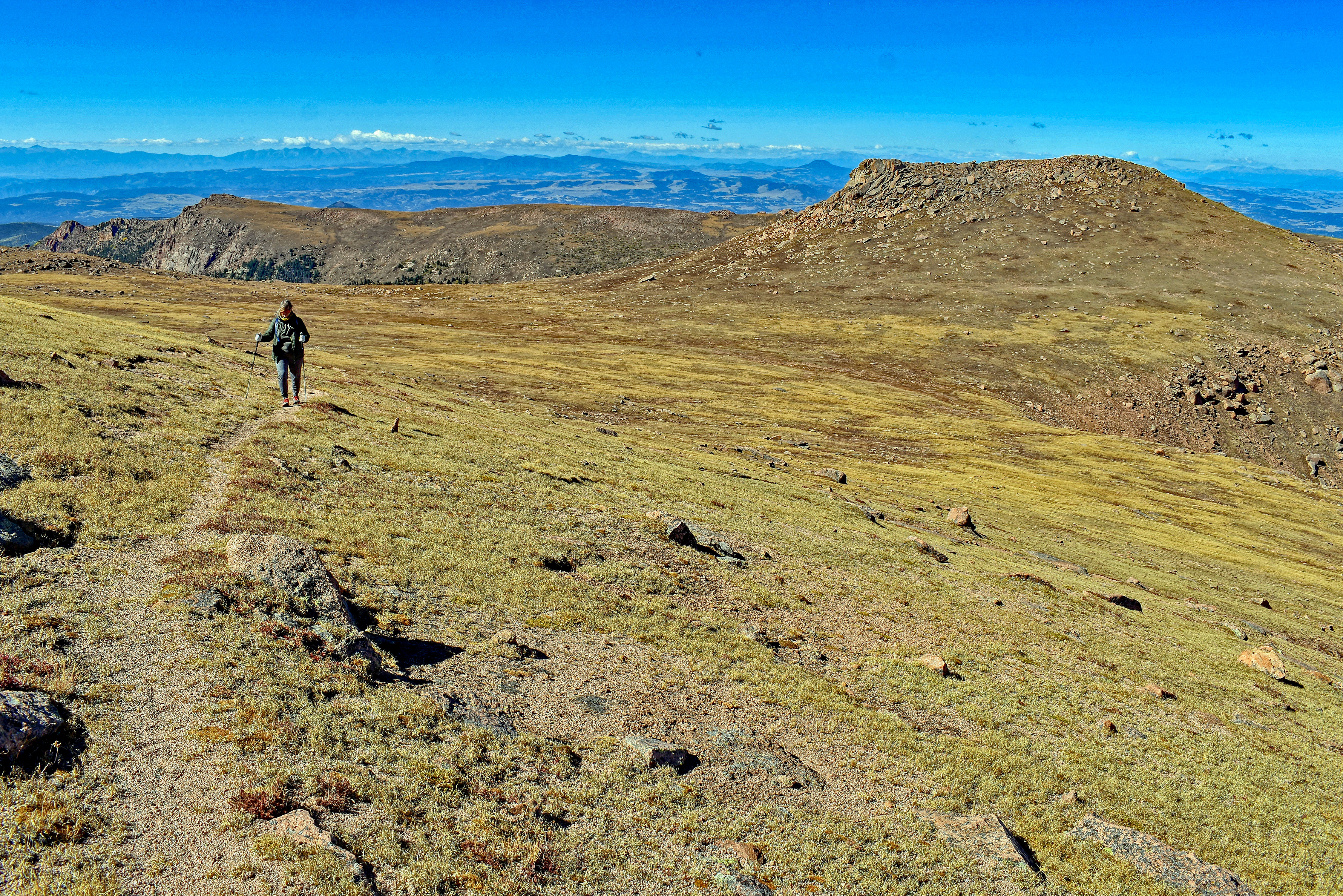
Last week, I decided to take the easy route up Pikes Peak. I drove. To make the most of my day (and my money), I added a few easy hikes to the trip: four unranked summits off the highway on the west side of the peak. I’d done two of them before, but two others were new to me. I’d discovered them in Stewart M. Green’s book Climbing Pikes Peak: A Hiker’s Guide to the Peak.

I’ll give you a summary of the directions. If you want more details, pick up the book. It has other hikes including more summit hikes too, plus a bunch of route descriptions to the top of Pikes Peak.

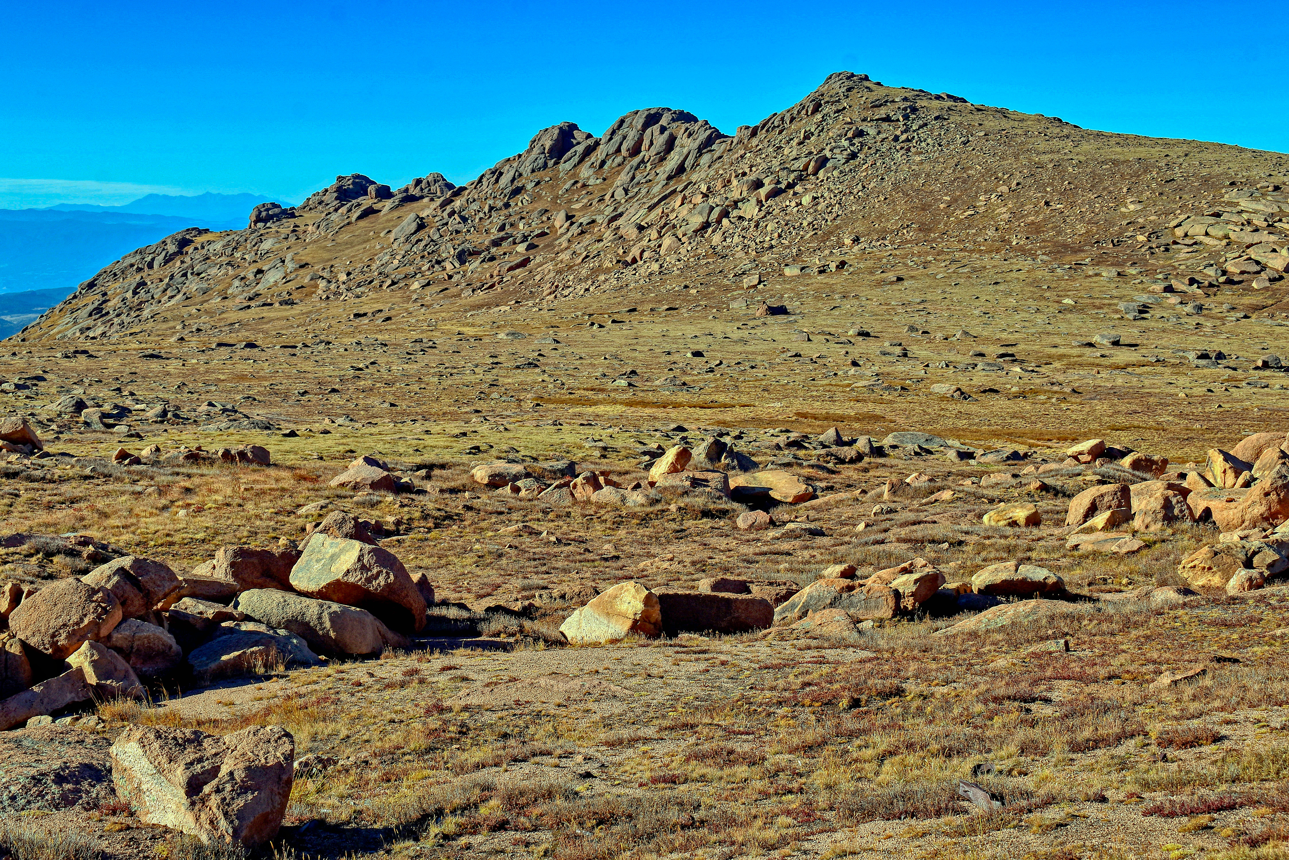
Spencer’s Rest (12,939′) and Bob Ormes Points (13,119′) Unranked

This hike starts on the north side of the Pikes Peak Highway between mile markers 17 and 18. If you’re driving up the road, it’s the pullout on the left just below “Little Pikes Peak.” After you cross the road, look for the faint Gillett Trail. I’d been on the trail a couple of times: in 2005, when I hiked to the summit of Pikes from Gillett, and in 2013, to climb “McReynolds Peak.” Seldom used except by peakbaggers trying to finish all the ranked summits in Teller County (McReynolds), the trail is overgrown but it’s there. If you lose it, step on rocks and slabs to avoid damaging mountain tundra until you locate it again. Spencer’s Rest is west-southwest of the pullout.

Spencer’s Rest is a short easy hike off the Pikes Peak Highway on the west side of Pikes Peak. Photo by Stewart M. Green.

Next, descend the peak and hike east to the northernmost highpoint of a long ridge of summits, Bob Ormes Points. Alternatively, you can start at the southernmost point and hike the ridge to the highest point.

The whole hike is short, less than three miles, and with less than 1,000 feet of elevation gain you can do both Spencer’s Rest and Bob Ormes Points and be back to you car in an hour. You’ll want to linger on the summits, though – the views are stupendous!

Bob Ormes Points are a short hike from Spencer’s Rest. Photo by Stewart M. Green.

“Little Pikes Peak” (13,363′) Unranked

Back at your car, you can either do “Little Pikes Peak,” located near the pullout, or drive to the summit for doughnuts and more views, like I did. On the way back down the highway, park at the same pullout (between mile markers 17 and 18, this time on the right side of the road). “Little Pikes Peak” is the obvious rocky summit west of the pullout. I hadn’t done this hike since 2008 and it hadn’t changed: still short, still steep, and still bouldery on top. Again, avoid the tundra and look for rocks and slabs for your footing.

Little Pikes Peak viewed from the Gillett Trail. Photo by Stewart M. Green.

Next, continue driving down the road for another 1.6 miles to the Devils Playground parking lot on the left side of the road.

“Devils Playground Peak” (13,070′) Unranked

If you’ve ever climbed Pikes Peak from the Crags Trailhead in Divide, you know that the Devils Playground parking lot is where you leave the trail and cross the Pikes Peak Highway for the final 2.6 miles to the summit. County highpointers know it as where to park to get the highpoint of Teller County, “Devils Playground Peak.” This little summit used to be a bit of a scramble, but now there’s a trail. I’ve done it three times – in 2008, 2012, and last week – and for some reason, I failed to take a photo on any of those hikes. The peak is hard to miss – it’s the obvious bump on the west edge of the lot. There’s a trail.

There you have it. Four easy summits and a lovely drive to the top of America’s Mountain. Not a bad day!

Find details to these hikes and many more in Climbing Pikes Peak.

Wheelchair- and Stroller-Friendly Waterfalls & Alpine Lakes in Colorado

We found three alpine lakes and four gushing waterfalls that offer refreshing, cool fun for the whole family, including those using strollers or wheelchairs.

Read my full story on 5280.com: Wheelchair- and Stroller-Friendly Waterfalls & Alpine Lakes in Colorado

A wide footbridge over Boulder Brook leads to the Sprague Lake Loop Trail, a 0.7-mile, hardpacked dirt and gravel trail in Rocky Mountain National Park near Estes Park, perfect for wheelchairs, strollers, and other mobility devices. Photo by Susan Joy Paul

Estes Park’s Quinn Brett Is a Champion for Adaptive Sports and Backcountry Access

Adventurer Quinn Brett, who is paralyzed from the waist down, thinks Colorado can do better when it comes to adaptive sports and recreational opportunities—and she’s helping to make that happen.

Read my full story on 5280.com: Estes Park’s Quinn Brett Is a Champion for Adaptive Sports and Backcountry Access

Quinn Brett advocates for the protection of public lands and improved access to it for adaptive sports enthusiasts like herself. Photo of Quinn by Andy Earl, courtesy of Quinn Brett

Trains, Pontoons & Hot Air Balloons: Hitch a Ride to Colorado’s Backcountry

Getting into the backcountry can be hard work, but not every adventure requires extreme exertion. We found six fun and easy ways to enjoy Colorado’s great outdoors without lifting a finger—or pulling a muscle.

Read my full story on 5280.com: Trains, Pontoons & Hot Air Balloons: Hitch a Ride to Colorado’s Backcountry

See the southern Front Range and Pikes Peak from a new perspective when you soar on a hot air balloon over Colorado Springs. Photo courtesy of Rainbow Ryders Hot Air Balloon Ride Co.

4 ADA-Compliant Colorado Hot Springs

From soaking facilities with ADA-compliant lifts to pools with ramps, handrails, and benches, we found a soothing Colorado hot springs experience for nearly every ability and mobility.

Read my full story on 5280.com: 4 ADA-Compliant Colorado Hot Springs

Ramps, lifts, railings, and benches ensure easy access for all at scenic Ouray Hot Springs Pool. Photo by Stewart M. Green

5 Scenic Overlooks in Colorado You Can Reach in Your Prius

From 14,000-foot mountaintops to roadside pulloffs and a lofty memorial site, passenger cars will have no trouble reaching these five scenic overlooks located within about two hours of Denver, from Rocky Mountain National Park to Pueblo.

Read my full story on 5280.com: 5 Scenic Overlooks in Colorado You Can Reach in Your Prius

The Forest Canyon scenic overlook in Rocky Mountain National Park is just steps from Trail Ridge Road. Photo by Susan Joy Paul

Summertime Waterfall Roundup

June is my favorite month for hiking to Colorado waterfalls. That’s when springtime snow, warmed in the sunshine, releases its bounty of crystal clear, liquid goodness. Shimmering cascades, horsetails, and cataracts tumble down mountainsides, pour over rocky ledges, and fling themselves off high cliffs. Even though snowpack is in short supply this year, you can still catch some lovely falls in the Pikes Peak region.

Your first stop should be North Cheyenne Cañon, where you can drive up North Cheyenne Canyon Road for about 2.5 miles to Helen Hunt Falls, formed by North Cheyenne Creek. From the base of the falls, take a short, steep hike up to Silver Cascade (Spoon) Falls, formed by Buffalo Creek. This is a busy area that can become quite congested, so slow down as you drive through and be on the lookout for pedestrians. Likewise, if you cross the road to the falls, be aware of vehicles from both directions.

HWFCO-Helen-Hunt.jpg

Helen Hunt Falls, North Cheyenne Cañon

Next, drive to the top of North Cheyenne Canyon Road and park in the big lot at the junction of High Drive and Gold Camp Road. From there, Undine Falls is a 3.4-mile out-and-back hike on the Seven Bridges Trail. Start at the northwest end of the parking lot and hike the old railroad bed (the section of Gold Camp Road that’s closed to vehicles) and cut off the trail at the sign for Trail #622 on the right. The falls are just past the seventh bridge.

IMG_3485

Undine Falls, North Cheyenne Cañon

For a longer hike, bypass the cutoff to Trail #622 and continue on Gold Camp Road past the closed tunnel on the right, and look for the very old sign for Saint Mary’s Falls on Buffalo Creek. It’s a 6-mile out-and-back hike that gains quite a bit of elevation, so allow yourself plenty of time and watch for bikers zooming down the trail. They are supposed to afford hikers the right of way, but not all of them are aware of that fact, or they choose to ignore it. Keep your eyes open and if you see one coming, make your presence known. If there’s room, try to step off the trail to avoid a collision.

ST MARYS 3

St Marys Falls, North Cheyenne Cañon

Josephine Falls, in nearby Bear Canyon, is no longer accessible due to the Bear Creek Watershed Restoration Project that closed the trail. A newer trail high above the canyon is the closest you’ll get, but not worth the hike if you’re just going to visit the falls, as they’re hidden far below the trail and a quarter of a mile away. Instead, drive back down North Cheyenne Canyon Road and park in the small lot at the Mount Cutler Trailhead. Hike about a mile up the trail and look to the south for unobstructed views of Seven Falls. Hang onto your kids and your pets on this trail, as there’s dramatic exposure and a tumble off the edge could be fatal.

Josephine Falls Hike (29)

Josephine Falls is no longer accessible due to the Bear Creek Watershed Restoration Project

Dorothy Falls and Williams Canyon Falls aren’t legally accessible right now, as the trails were closed for safety reasons after the September 2013 floods.

SONY DSC

Dorothy Falls at Glen Eyrie has been closed to the public since the 2013 floods

Rainbow Falls is also closed, but the area is undergoing renovations and should be opening next month. This is one of the prettiest waterfalls in the area so put that one on your calendar and check the El Paso County Parks website for updates.

111009 - Rainbow, Crystal-1, Catamount & Williams Canyon 032

Rainbow Falls, Manitou Springs is scheduled to reopen in July after restoration is complete

If you don’t mind a little driving, head west on Highway 24 to Green Mountain Falls, where you can hike the Thomas Trail to Crystal Falls and Catamount Falls. Then, check out Horsethief Falls in Teller County, and Guffey Falls and Tarryall Falls in Park County.

Want more falls? Keep driving – and hiking! According to the Worldwide Waterfall Database, there are 467 known waterfalls in Colorado. Once you get into the mountainous areas in Rocky Mountain National Park to the north; around Pagosa Springs, Telluride, and Ouray in the southwest part of the state; and in the canyons around Grand Junction to the west; they’re bigger, bolder, and even more dramatic.

As with all your outdoor adventures, leave nothing behind on your waterfalls hikes, and take nothing with you but some glorious photos and a smile. Your children and your children’s children will thank you for taking such great care of these lovely gems, Colorado’s waterfalls, so they can enjoy them for years to come.

For information on more than 100 waterfalls in the Pikes Peak region and across the state, check out my Falcon Guide Hiking Waterfalls in Colorado.

This blog first appeared as a column in the June 13, 2018, Woodmen Edition of the Gazette Community News.

Farewell to the Pikes Peak Cog, for Now

I read the news of the Pikes Peak Cog Railway shutdown with mixed feelings. This is the train that transports people from Manitou Springs, Colorado, to the summit of America’s Mountain, 14,115-foot Pikes Peak. The annual temporary winter closure for routine maintenance has become an extended decommissioning of two to three years while the railway’s owner, the Broadmoor, evaluates options for rebuilding or replacing the train, tracks, and depot. The result may be that it never runs again.

My initial reaction was: this is probably a good thing. Like many Coloradans, I enjoy the outdoors, support the Leave No Trace principles, and believe the best 14ers are those that get the least traffic. That part of me would like to see the railway, the summit house – and the Pikes Peak Highway, for that matter – close for good.

But another part of me was struck with sadness and a bit of sentimentality. Why did the news bother me? Why did I care about the closing of a silly red train that hauls tens of thousands of “outsiders” (you know – sniff! – tourists) to the top of our mountain every year? I had to clear a lot of cobwebs – and “jog the cogs” – from my memory to sort out this strange emotional attachment I felt for the train.

Twenty years ago, I took my two boys for a ride on the cog railway. The nearly nine-mile ride from Manitou Springs through subalpine forest and finally, above tree line, seemed to take forever but the conductor kept us amused with the history of the train and Pikes Peak. He even threw in an occasional quip that caused my kids to roll their eyes. As a mom, it’s always a pleasure to see your kids roll their eyes at something other than you.

Wandering the summit was a thrill. It was our first time over 14,000 feet and my kids (who at that age seemed to relish offsetting my enthusiasm for everything by never being impressed by anything) actually seemed to get a kick out of the views. We drank hot chocolate, gobbled up doughnuts, and purchased a couple of gleaming pressed pennies as souvenirs. It was a good day out.

I never rode that fancy red and white train again, but I did revisit the tracks. In November 2006, during the Zebulon Pike Bicentennial Reenactment hike, my group of eight emerged from the forest to pick up the tracks south of Sachett Mountain at 12,000 feet and follow them to the summit. It was 9 degrees and a light snow was beginning to fall. As eager as I was to finish the three-day trek, I slowed down toward the end to savor those last feet of train tracks, knowing I would probably never walk them again.

A couple of years later, after a January hike to the top of Pikes Peak via the “Crags Route” from Divide, I saw the train again. The summit house was closed that day and the entryway was packed with snow, offering little protection from the biting wind. I pressed my back against a drift and sipped hot cocoa from a thermos, trying to warm my chilled bones, but it was no use. It was just too darned cold up there to enjoy the summit, so I told my hiking partner I needed to head down. Suddenly, a whistle shrieked. My buddy and I looked at each other. Maintenance workers? Today? We continued packing up our backpacks for the long hike down, but then the train appeared – pulled up right in front of us! Hundreds of tourists peered out the windows at the two of us. We must have looked like frozen guards, covered in frost and sitting in the snow at the entry to the summit house. Some workers jumped from the train, cleared a path to the doors, and opened the place up. We filled up on coffee and doughnuts and thanked the tourists who offered to help us “find a way down.” They thought we were lost and had ended up on the top of Pikes Peak by accident! Then we headed down – on foot.

Later that year, in December, I found myself crossing the tracks during a descent of another peak in the nearby Manitou Springs quad. It was December, there was a lot of snow, and my hiking buddy and I assumed the train wasn’t running (how soon we forget!) so we weren’t worried about being run over – or being “caught” as we suspected that walking the tracks probably wasn’t legal.

I guess I never realized how quiet the cog train is. It came around the corner like a wall of red. The train engineer looked as shocked to see us and we were to see him! We leapt from the tracks and into the snow. That was the last time I hiked across the cog tracks.

My last encounter with the cog railway wasn’t on the red and white train, but on Carriage 104, one of the original train cars. In 2016, the cog celebrated its 125th anniversary and visitors were treated to a quarter-mile “push” up the tracks by Steam Engine Number 4, an older version of the train that had been retired in 1958. While I appreciated the history lesson, being pushed – rather than pulled – by an engine is a very different experience. I don’t know if I would have enjoyed a 1950s 9-mile trip that way, being jostled up those tracks!

I’m sure many Coloradans have their own Pikes Peak Cog Railway stories. Trains, peaks, and outdoor adventures are all part of our state history and what made this place what it is today.

Reconciling my railway nostalgia with a desire to protect the peaks is difficult. The balance between sustainability and accessibility is delicate and not always convenient. A few years’ rest from all those visitors would surely do old Pikes Peak some good, but I hope someday the owners of the Pikes Peak Cog Railway find a way to get the train moving again.

This blog first appeared as a column in the March 28, 2018, Woodmen Edition of the Gazette Community News.

The Downside of Highpointing

Goals are fun to reach, but as they say, it’s the journey that makes them worthwhile. I was reminded of that fact last week when I met with a group of fellow hikers to sign the Colorado County Highpointers Ice Axe.

img_4442

Signing the Colorado County Highpoint Ice Axe [Photo] Stewart M. Green

Yes, there are people out there who try to get to the top of every county in Colorado. Actually, there are people who do this in every state. Hikers who reach the summits of all 64 Colorado counties are invited to sign a ceremonial ice axe. The tradition was started by Dave Covill and John Mitchler who aren’t just avid highpointers, they literally wrote the book on Colorado county highpoints, “Hiking Colorado’s Summits” (FalconGuides, 1999). The two men share a hobby of getting to the highest points of things: states, counties, countries, mountain ranges, national parks and monuments, major cities – and even, I learned last week – golf courses. Highpointing is a fun challenge that takes you to places you might typically never visit.

Hardcore mountaineers like to poke fun at highpointers because some of our achievements aren’t really all that impressive. For example, reaching the highpoints of certain Colorado counties on the eastern plains demands nothing more than a long drive on dirt roads followed by wandering around cow pastures with a hand level and a GPS – with the landowners’ permission, of course. The metro Denver county highpoints are roadside, and one is paved. But other highpoints are much more challenging. Weld County’s highpoint is located on a bison farm. It’s not a tough hike, but avoiding that large herd of 1,000-pound, curious bison was an experience I’ll never forget.

I started highpointing while I was working on another list, all the Colorado 14,000-foot peaks, or 14ers. There were times when the avalanche danger was too high to safely pursue the big peaks, and so having another list to fall back on gave me an opportunity to get out of the house, hike or climb something, and check off a peak on a list! I ticked off the eastern plains and metro Denver highpoints, which when added to the 14,000-foot highpoint peaks accounted for a majority of summits on the county highpoints list. My quest got a lot more interesting after that, taking me all over the state to places like Clark Peak in the Rawah Wilderness east of Walden, Mount Zirkel in the Mount Zirkel Wilderness near Steamboat Springs, Flat Top Mountain in the Medicine Bow-Routt National Forest, and Hagues Peak in the Mummy Range of Rocky Mountain National Park. To the south, Pueblo County’s Greenhorn Mountain and Las Animas County’s West Spanish Peak, both visible from I-25, gave me an excuse to visit the towns of Rye and La Veta, and the views – well, you’ll just have to go up there yourself. They are stunning.

I finished my county highpoint journey on Vermilion Peak in the San Juan Mountains above Ice Lake Basin near Silverton. It was one of the toughest peaks of the lot and I don’t know why I left it until last, but it was a joy to be up there enjoying the views, knowing I had finally completed a goal started years ago on El Paso County highpoint Pikes Peak. It was a sad experience, too, because it was the last peak on the list. I know that sounds silly, but I didn’t want it to be the last. I wanted more highpoints.

I was the 36th person to sign the axe last week, joined by #37 Doug Hatfield, #38 David Johnson, and #39 Mike Offerman. I’m sure many more people will pursue the Colorado County Highpoints list and finish it, too. If you’re one of those people, take a moment up there on those summits. Don’t be in a hurry to come back down. It’s nice up there, and sometimes you don’t realize just how nice until after you’ve done them all.

vemilionpeak_summit_0204_2-2

Summit of Vermilion Peak, September 19, 2015. [Photo] Stewart M. Green

This column first appeared in the September 28, 2016 Woodmen Edition of the Gazette Community News.